Professional Commercial Drone Services Across Ohio
About TerrainPro
Bellefontaine's premier FAA Part 107 certified drone team
TerrainPro is Bellefontaine’s premier FAA Part 107 certified commercial drone services company. With 11 years of hands-on commercial experience — including time working directly for and with drone and UAS manufacturing companies and military contractors — we bring industry-leading expertise to every project.
Whether you need precision mapping, search and rescue support, or stunning aerial photography, TerrainPro has the training, equipment, and experience to deliver.
Terrain Pro LLC
The right tool for every job
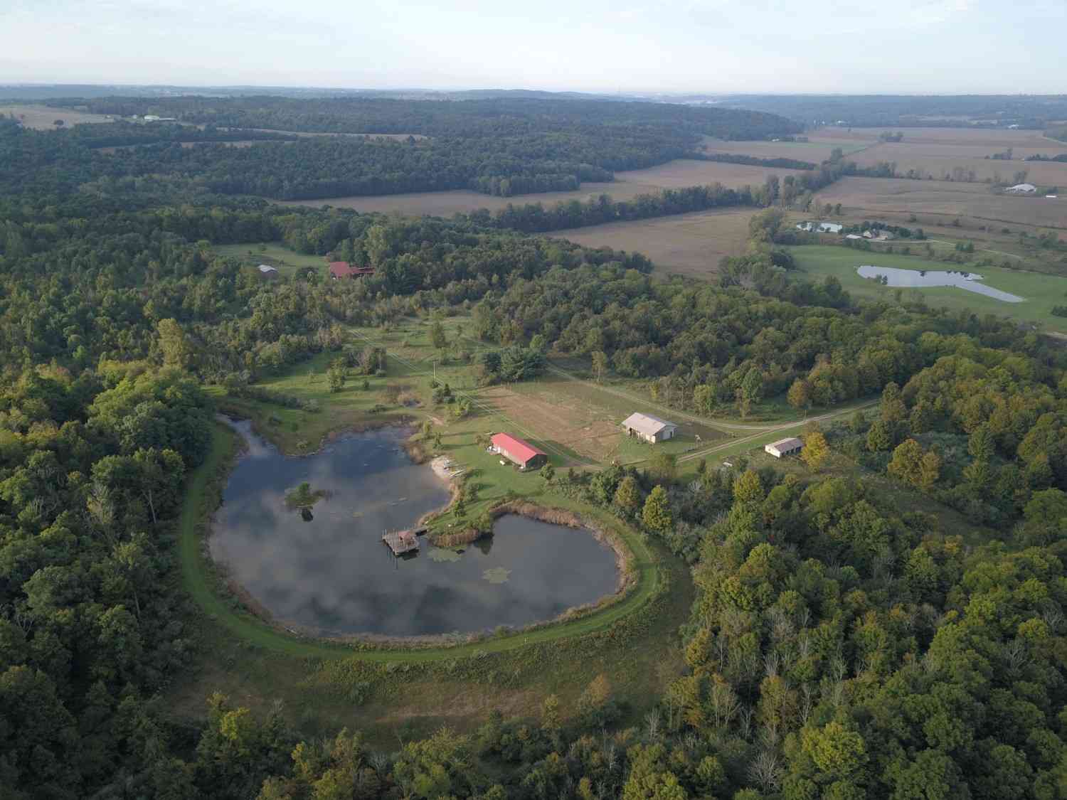
Aerial Mapping and Photogrammetry Surveys
Accurate aerial maps and photogrammetric surveys for land clearing, construction, real estate, and development projects. We capture high-resolution imagery processed into precise 2D maps and 3D models you can actually use for project planning and decision-making.
What you get:
- High-resolution orthomosaic maps
- Digital elevation models (DEMs)
- 3D point cloud data and terrain models
- Topographic survey data
- GIS-compatible file formats
- CAD-ready deliverables
Land Survey and Site Planning
Get the data you need before a single machine moves. Our pre-project drone surveys identify terrain challenges, measure volumes, plan access routes, and document baseline site conditions — saving you time, money, and surprises on the job.
What you get:
- Full site boundary and terrain mapping
- Cut and fill volume analysis
- Access road and staging area planning
- Existing conditions documentation
- Drainage and erosion assessment
Project Progress Monitoring
Document every phase of your project with scheduled aerial overflights. Ideal for land clearing, construction, and development projects — show clients exactly what's been accomplished, verify milestones, and maintain a complete visual record from start to finish.
What you get:
- Before, during, and after aerial photography
- Time-lapse project documentation
- Progress comparison reports
- Client-ready visual updates
- Milestone verification documentation
Advanced Sensor Operations
TerrainPro is trained and experienced in specialized sensor payloads beyond standard cameras. We deploy the right tool for the job — whether that is thermal imaging, multispectral sensors, LiDAR, or other advanced systems.
What you get:
- Thermal imaging for infrastructure and equipment inspection
- LiDAR data collection for high-precision terrain modeling
- Multispectral data for vegetation and land analysis
- Equipment and site safety inspections
Crop Health and Agricultural Services
Precision agriculture starts with accurate data. Our multispectral and NDVI imaging identifies crop stress, irrigation issues, and yield variation across your fields — giving you the information you need to make better decisions faster.
What you get:
- NDVI and multispectral crop health maps
- Irrigation and drainage problem identification
- Field-by-field yield variation analysis
- Seasonal monitoring and comparison reports
- Actionable recommendations
Aerial Photography and Estate Videography
Showcase your property, project, or business with professional-grade aerial photography and video. TerrainPro delivers cinematic footage and high-resolution stills that make an impression — for real estate listings, estate documentation, marketing, and more.
What you get:
- High-resolution aerial photography
- 4K aerial video footage
- Edited highlight reels and full-length video
- Real estate listing packages
- Before and after project showcases
Search and Rescue Support
TerrainPro has direct experience supporting search and rescue operations with drone technology. We work with emergency response teams to cover large areas quickly, locate missing persons, and provide real-time aerial intelligence when it matters most.
What you get:
- Thermal imaging for person detection in low-light and dense terrain
- Large area grid search coverage
- Real-time video feed to ground teams
- GPS coordinate pinpointing
- Rapid deployment and on-site coordination
Why TerrainPro
Experience you can count on
- FAA Part 107 Certified Commercial Pilot
- 11 years of hands-on commercial drone experience
- Background working directly for and with drone and UAS manufacturing companies and military contractors
- Trained in photogrammetry, advanced sensors, search and rescue, and aerial imaging
- Fully insured commercial operations
- Experienced in Ohio terrain, weather, and agricultural environments
- Professional deliverables in all standard formats
Service Areas
Proudly serving all of Ohio
TerrainPro proudly serves clients across the state of Ohio — from our home base in Bellefontaine to projects statewide. Whether you’re in Central Ohio, Northwest Ohio, Southwest Ohio, or anywhere in between, we come to you.
Logan County
Bellefontaine, Russells Point, Lakeview, West Liberty
Union County
Marysville, Plain City, Richwood
Delaware County
Delaware, Powell, Westerville, Lewis Center
Hardin County
Kenton, Ada, Forest
Champaign County
Urbana, St. Paris, Mechanicsburg
Franklin County
Columbus and surrounding metro
Marion County
Marion, Caledonia, La Rue
Auglaize County
Wapakoneta, Saint Marys, New Bremen
Pricing
Transparent, upfront pricing
TerrainPro believes in transparent, upfront pricing so you know exactly what you’re getting before we fly. All projects begin at the rates listed below — final pricing is based on project scope, acreage, and deliverable requirements. Contact us for a free project consultation and custom quote.
Land Survey & Site Planning
100 acres or less
Begins at $500
Aerial Mapping & Photogrammetry
200 acres or less
Begins at $450
Crop Health & Agricultural Imaging
100 acres or less
Begins at $600
Search & Rescue with Thermal
Hourly rate
$250 per hour
Estate Photo & Video Packages
Per project
Begins at $350
Project Progress Monitoring
Per visit
Begins at $350 per visit
Pricing for larger acreage, multi-day operations, or specialized sensor deployments is available upon request.
Ready to put drone technology to work on your project?
Contact TerrainPro today for a free consultation.